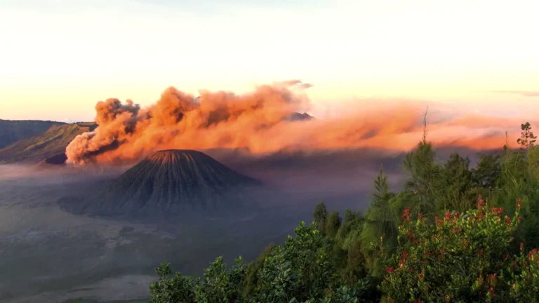
The Mount Bromo caldera is a vast, ancient volcanic depression in East Java, Indonesia, known geologically as the Tengger Caldera. This immense structure measures approximately 8-10 kilometers in diameter, encompassing a striking landscape of sand, a collection of volcanic peaks including the active Mount Bromo, and several dormant cones. Its sheer scale makes it one of the most remarkable volcanic features in the world, offering breathtaking views and a unique geological experience.
Quick Facts About Mount Bromo & Its Caldera
Understanding the Tengger Caldera: A Giant’s Footprint
The question of “how big is the Mount Bromo caldera” refers to the broader geological feature known as the Tengger Caldera. This colossal depression is the remnant of a massive ancient volcano that collapsed after colossal eruptions, forming a basin of truly epic proportions. This isn’t just a small crater; it’s a monumental landscape that stretches for miles, captivating visitors with its dramatic and otherworldly beauty.
The Vast Scale of the Tengger Caldera
The Tengger Caldera, which houses Mount Bromo, is a sprawling expanse. Its approximate diameter ranges from 8 to 10 kilometers (5 to 6.2 miles) from rim to rim. To put this into perspective, imagine a natural amphitheater so vast that it contains an entire desert, several mountains, and an active volcano all within its bounds. This impressive scale is a direct result of ancient volcanic activity, where the pressure beneath the earth became so immense that the volcano’s summit collapsed inwards, creating the magnificent geological depression we see today. The caldera’s size contributes significantly to the feeling of awe and isolation experienced by those who venture within its boundaries, making it a truly unique destination for geology enthusiasts and travelers alike.
The Sea of Sand (Laut Pasir)
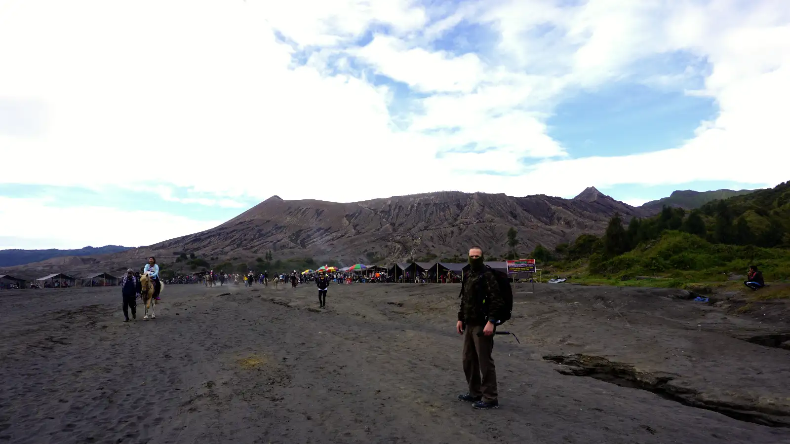
Within the immense Tengger Caldera lies the “Laut Pasir” or Sea of Sand. This vast, flat, and often eerie expanse of volcanic ash and sand covers an area roughly 5-6 kilometers (3.1-3.7 miles) in diameter. It’s a surreal, lunar-like landscape that offers a stark contrast to the verdant slopes surrounding the caldera. Traversing the Sea of Sand by jeep feels like entering another world, with the fine, dark ash crunching under tires, leading towards the towering cones of the active volcanoes. This unique environment is an integral part of the Bromo experience, providing a dramatic foreground to the smoking crater of Mount Bromo and its companion peaks.
Prominent Peaks Within the Caldera
The Tengger Caldera isn’t just an empty basin; it’s home to several volcanic cones that have emerged since its formation. The most famous, of course, is Mount Bromo, an active stratovolcano recognizable by its constantly smoking crater. However, Bromo is not alone. Nearby stands Mount Batok, a beautifully conical and dormant volcano whose symmetrical slopes are often photographed alongside Bromo. Other peaks like Mount Widodaren and Mount Kursi also rise from the sandy plains, contributing to the dramatic skyline within the caldera. These diverse volcanic landforms within a single caldera provide a living textbook of geological processes.
The Active Crater of Mount Bromo
While the Tengger Caldera represents the immense overarching structure, Mount Bromo itself refers to the active, smaller cone within the Sea of Sand. This is the heart of the volcanic activity and the primary destination for most visitors seeking to witness the raw power of nature up close.
Bromo’s Sulphurous Heart
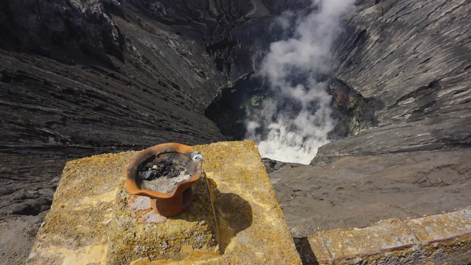
The active crater of Mount Bromo measures approximately 800 meters (0.5 miles) in diameter. From the crater rim, accessible via a flight of stairs from the base, visitors can peer directly into its smoking depths. A constant plume of white sulfurous gas billows upwards, a tangible reminder of the volcano’s ongoing activity. The air here carries a distinct, pungent sulfur scent, and the volcanic soil is a mixture of dark ash and rock. The experience of standing on the rim, feeling the rumble of the earth, and witnessing the raw energy of the crater is profoundly impactful, a testament to the dynamic forces shaping our planet.
A Geological Marvel: Formation and Activity
Mount Bromo is part of the larger Tengger volcanic complex, which is one of Indonesia’s most active and prominent volcanic regions. Its current form is a result of numerous eruptions and geological shifts over millennia. The caldera itself was formed by the collapse of an ancient, much larger volcano. Subsequent eruptions then built up new cones within this depression, with Bromo being the most active and continuously evolving. It’s classified as a stratovolcano, characterized by its conical shape and explosive eruptions. While Bromo’s eruptions are typically moderate, its constant activity means it’s a closely monitored volcano, offering a fascinating glimpse into Earth’s fiery interior.
Planning Your Visit to Mount Bromo
Visiting Mount Bromo requires careful planning to maximize the experience. Its location in East Java means specific logistical considerations, especially for those aiming to catch the iconic sunrise.
Essential Logistics: Getting There
Most travelers approach Mount Bromo from cities like Probolinggo, Malang, or Pasuruan, which serve as gateway towns. From these points, local transportation, often arranged through tours, will take you to the entrance of Bromo Tengger Semeru National Park. A crucial logistical detail is the mandatory use of a 4WD jeep for traversing the vast Sea of Sand within the caldera. Private vehicles are generally not permitted beyond certain points to protect the delicate ecosystem and manage visitor flow. For those traveling from Bali, the journey typically involves a ferry crossing from Gilimanuk to Ketapang (Java), which takes approximately 45-60 minutes. It’s important to remember that Java operates on UTC+7 (Western Indonesian Time), while Bali is UTC+8 (Central Indonesian Time), so adjust your clock accordingly.
Best Time for a Sunrise View
The best time to visit Mount Bromo for the breathtaking sunrise views is during Indonesia’s dry season, which generally runs from May to October. During these months, the weather is typically clearer, and the chances of fog or rain obstructing the views are significantly lower. Sunrise tours usually start in the early hours of the morning, often around 3:00 AM, to reach viewpoints like Penanjakan 1 (2,770 meters elevation) well before dawn. The temperatures at these elevations before sunrise can drop considerably, sometimes to 3°C, necessitating warm clothing.
Combining Bromo with Ijen Crater
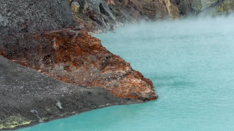
Many travelers choose to combine a visit to Mount Bromo with the equally stunning Ijen Crater, famous for its mesmerizing blue flames and acidic lake. Ijen offers a different kind of volcanic experience, located further east in Java. Important facts for Ijen include: the base camp at Paltuding is at 1,850m, the summit is at 2,386m, and the striking turquoise lake has an incredibly low pH of less than 0.5. A health certificate (Surat Keterangan Sehat) is mandatory for visitors to Ijen. The official trail usually opens at 02:00 AM WIB (Western Indonesian Time) for those hoping to see the blue flames. These two volcanoes, Bromo and Ijen, together offer an unforgettable East Java volcanic adventure. To plan your journey, consider exploring options that combine both destinations: Book Your Trip Now.
Local Knowledge and Ground Evidence
Experiencing Mount Bromo is not just about its immense size but also the sensory details that immerse you in its unique environment. As you wait for sunrise at Penanjakan, the bracing wind can drop temperatures to a chilly 3°C, making warm layers, hats, and gloves absolutely essential. The smell of local warung coffee wafting from small stalls provides a comforting warmth against the morning chill, a quintessential Indonesian experience.
Descending into the caldera, the vast Sea of Sand reveals itself, a gravelly and dusty expanse. Here, you’ll feel the unique texture of volcanic ash underfoot, a subtle crunch as you approach the base of Mount Bromo. The air around the crater is thick with the distinct, metallic scent of sulfur, a constant reminder of the volcano’s active nature. This smell intensifies closer to the crater rim, where the faint roar of the internal volcanic activity is sometimes audible. Beyond the geology, understanding the local Tenggerese people and their deep spiritual connection to Mount Bromo, evidenced by ceremonies like Yadnya Kasada, adds another layer of appreciation to this extraordinary destination.
Frequently Asked Questions
How big is the Mount Bromo caldera?
The Mount Bromo caldera, officially known as the Tengger Caldera, is approximately 8 to 10 kilometers (5 to 6.2 miles) in diameter. It’s a vast volcanic depression containing the Sea of Sand and several peaks, including the active Mount Bromo.
What is the “Sea of Sand”?
The “Sea of Sand” (Laut Pasir) is a large, flat expanse of volcanic ash and sand located within the Tengger Caldera. It spans about 5-6 kilometers and must be traversed by 4WD jeep to reach the base of Mount Bromo.
Is Mount Bromo still active?
Yes, Mount Bromo is an active stratovolcano. It frequently emits sulfurous smoke and experiences relatively small, localized eruptions, making it a closely monitored volcanic site.
What is the best viewpoint for Mount Bromo?
Penanjakan 1 (at 2,770m elevation) is widely considered the best viewpoint for a panoramic sunrise over the entire Tengger Caldera, including Mount Bromo, Mount Batok, and Mount Semeru in the distance.
Do I need a 4WD to visit Bromo?
Yes, a 4WD jeep is mandatory to traverse the Sea of Sand within the national park to reach the base of Mount Bromo. Private vehicles are generally not allowed on this section of the journey.
What should I wear for a Bromo sunrise trip?
Due to the high elevation and early morning hours, temperatures can drop significantly (around 3°C). Layers of warm clothing, a thick jacket, hat, gloves, and comfortable walking shoes are highly recommended.
Can I visit both Bromo and Ijen?
Absolutely. The Bromo-Ijen tour is a very popular itinerary for travelers to East Java, offering two distinct and incredible volcanic experiences. Many tour operators provide combined packages for convenience.
What is the pH of Ijen’s lake?
The crater lake of Ijen is renowned for being the world’s largest highly acidic lake, with a pH typically less than 0.5. This extreme acidity is due to the high concentration of sulfuric acid and other volcanic gases.
Conclusion
The Mount Bromo caldera, or the magnificent Tengger Caldera, is an awe-inspiring natural wonder defined by its immense scale, stretching 8-10 kilometers across. This grand volcanic depression encompasses a unique landscape, from the vast Sea of Sand to the iconic, active cone of Mount Bromo itself, measuring around 800 meters in diameter. Understanding these dimensions helps appreciate the geological forces that have shaped this extraordinary destination. A visit offers not only a spectacular visual feast but also a profound connection to the raw power of Earth, making it an unforgettable journey into the heart of East Java’s volcanic heritage.